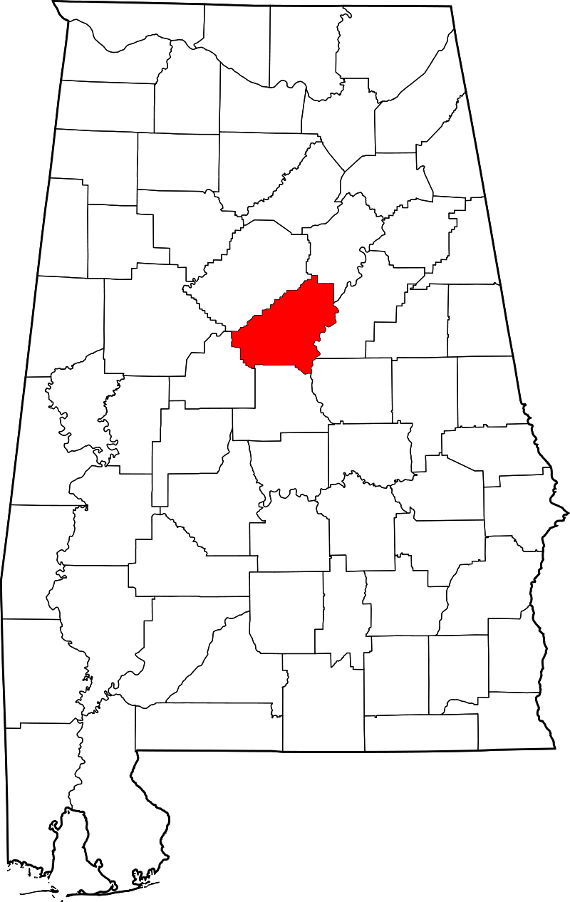
SHELBY COUNTY really is the HEART of Alabama!
Yep... Shelby County is located in the geographic center of Alabama. It was founded on February 7, 1818, by an act of the Alabama Territorial General Assembly and named after Isaac Shelby a Revolutionary War Hero. It has over 800 square miles and lands at the end of the Appalachian Mountains. The lush greenery and hills provide dramatic landscapes throughout the county.
Shelby County consists of 14 towns/cities or municipalities with hundreds of subdivisions. Each unique town offers a special trait and a historic monument or marker where the area citizens remember and celebrate its history.
Shelby County has its own public use airport (ICAO: KEET, FAA LID: EET) located four nautical miles (7 km) southeast of the central business district of Alabaster. It is owned by the Shelby County Commission and is situated in the city of Calera.
Shelby County has a long history in agriculture, and since about 1990, it has become an important location for growing soybeans, which has exceeded cotton as the most important crop grown here.
Additionally, Shelby County was the home of an early inland waterway, the Coosa River, and it was also the location of a very early east-west railroad in Alabama that connected Atlanta, Georgia, with locations to its west. Shelby County was also crossed by an early north-south railroad, the Louisville and Nashville Railroad, that connected Louisville, Nashville, Decatur, Birmingham, and Montgomery. You'll see this rail history throughout the county with ___ miles of rail running through the county.
In 1980 the Shelby County population was 66,298. And over the past 40 years, it has grown by almost 240% to 223,024 according to the 2020 census. When you experience this type of growth in population, you also must experience significant growth in housing (real estate). I mean, all these people need a place to live, right?! In the 1980’s we saw the majority of growth on the northern side of the county County, but that transitioned in the mid to late 1990s as more people discovered the estate lots, less traffic, and the slower pace offered in the southern section of the county.
If you are already a resident of Shelby County, congratulation!. You are well aware of the growth happening all over. If you are not a current resident of Shelby County and are interested in all the buzz, give us a call. We’d love to show you around and share with you about the GOOD LIFE offered here in Shelby County Alabama.
ALABASTER
The Alabaster city coordinates are 33.2443° N, 86.8164° W, and the city has a total area of 25.56 quare miles.
As of 2020 the population for Alabaster is 33,284 with a median family income of $89,803 and a median single family home value of $229,000.
Click here to learn more about Alabaster.
Click here to join our Alabaster FB page.
CLICK HERE
CALERA
The Calera city coordinates are 33.1029° N, 86.7536° W, and the city has a total land area of 24.43 square miles.
As of 2020 the population of Calera is 16,494 with a median family income of $69,732 a median single family home value of $189,085.
Click here to learn more about Calera
Clich here to join our Calera FB Page.
CLICK HERE
CHELSEA
The Chelsea city coordinates are 33.3401° N, 86.6303° W, and the city has a total land area of 23.48 square miles.
As of 2020 the population of Chelsea is 14,982 with a median family income of $97,727 and a median single family home value of $276,000.
Click here to learn more about Chelsea.
Click here to join our Chelsea FB Page.
CLICK HERE
COLUMBIANA
The Columbiana city coordinates are 33.1782, 86.6072, and the city has a total area of 17.4 square miles.
As of 2020 the population for Columbiana is 4,546 with a median family income of $45,581 and a median single family home value of $197,847.
Click her to learn more about Columbiana.
Click here to join our Columbiana FB page.
CLICK HERE
HARPERSVILLE
The Harpersville city coordintes are 33.3440° N, 86.4380° W, and the city has a total land area of 21.64 square miles.
As of 2020 the population of Harpersville is 1,729 with a median family income of $68,083 and a median single family home value of $206,590.
Click here to learn more about Harpersville.
Click her to join our Harpersville FB page.
CLICK HERE
HELENA
The Helena city coordinates are 33.2962° N, 86.8436° W, and the city has a total land area of 20.73 square miles.
As of 2020 the population of Helena is 20,914 with a median family income of $96,236 and a median single family home value of $288,000.
Click here to learn about Helena.
Click here to join our Helena FB Page.
CLICK HERE
HOOVER
The Hoover city coordinates are 33.4054° N, 86.8114° W, and the city has a total land area of 49.42 square miles.
As of 2020 the population for Hoover is 92,606 with a median family income of $110,995 and a median single family home value of $374,000.
Click here to learn more about Hoover.
Click her to join our Hoover FB page.
CLICK HERE
INDIAN SPRINGS VILLAGE
The Indian Springs Village coordinates are 33.3595° N, 86.7492° W, and the town has a total land area of 3.64 square miles.
As of 2020 the population for Indian Springs Village is 2,559 with a median family income of $127,500 and a median single family home value of $470,000.
Cick here to lean more about Indian Springs.
Click here to join our Indian Springs FB page.
CLICK HERE
MONTEVALLO
The Montevallo city coordintes are 33.1007° N, 86.8642° W, and the city has a total land area of 13.09 square miles.
As of 2020 the population of Montevallo is 6,902 with a median family income of $74,437 and a median single family home value of $175,000.
Click here to learn more about Montevallo.
Click here to join our Montevallo FB Page.
CLICK HERE
PELHAM
The Pelham city coordinatea are 33.2857° N, 86.8100° W, and the city has a total land area of 39.32 square miles.
As of 2020 the population of Pelham is 24,342 with a median family income of $105,410, and a median single family home value of $280,000.
Click here to learn more about Pelham.
Click here to join our Pelham FB page.
CLICK HERE
SHELBY COUNTY AIRPORT
The Shelby County Airport coordinate are 33°10′40″N 086°46′59″W, and the airport has a total land area of 125 acres. The elevation of the airport is 586 feet.
Click here to learn more about the Shelby County Airport.
Click here to joing the Shelby County Airport FB page.
CLICK HERE
VINCENT
The Vincent city coordinates are 33.3846° N, 86.4119° W, and the city has a total land area of 20.96 square miles.
As of 2020 the population of Vincent is 2,223 with a median family income of $47,339, and a median single family home value of $179,000.
Clich here to learn more about Vincent.
Click here to join our Vincent FB Page.
CLICK HERE
WESTOVER
The Westover city coordinates are 33.3535° N, 86.5274° W, and the city has a total land area of 19.57 square miles.
As of 2020 the population of Westover is 1,750 with a median family income of $74,375, and a median single family home value of $218,000.
Click here to learn more about Westover.
Click her to join our Westover FB page.
CLICK HERE
WILSONVILLE
The Wilsonville city coordinate are 33.2343° N, 86.4836° W, and the city has a total land area of 10.71 suare miles.
As of 2020 the population of Wilsonville is 2,064 with a median family income of $67,875, and a median single family home value of $270,000.
Click here to lean more about Wilsonville.
Click here to join our Wilsonville FB page.
CLICK HERE
WILTON
The Town of Wilton coordinates are 33.0787° N, 86.8817° W, and the town has a total land area of .96 square miles.
As of 2020 the population of Wilton is 18,503 with a median family income of $58,519, and a median single family home value of $145,000.
Click here to learn more about Wilton.
Click here to joint our Wilton FB page.
CLICK HERE